Spain Road Signs
Content index
- 1. Hazard Warning Signs
- 2. Regulatory Signs
- 2.1 Priority Signs
- 2.2 Denied Entry Signs
- 2.3 Traffic Restriction Signs
- 2.4 Other Prohibition or Driving Restriction Signs
- 2.5 Mandatory Signs
- 2.6 End of prohibition or restriction signs
- 3. Indication Signs
- 3.1 Traffic Lane Signs
- 3.2 Service Signs
- 3.3 Orientation Signs
- 3.3.1 Pre-signaling signs
- 3.3.2 Direction Signs
- 3.3.3 Road Identification Signs
- 3.3.4 Location Signs
- 3.3.5 Confirmation Signs
- 3.3.6 Specific Use in Town Signs
- 3.4 Complementary Panels
- 3.5 Other signs
Road signs of Spain are based on European Union regulations so that they are, if not the same, similar in all countries of the EU (Vienna Convention). Due to the importance of road safety, there is an international agreement to maintain the same format in vertical signage. Thus, although each country makes slight variations in the type of signals, the most important signals remain in common: stop, give way, etc. Speed limit signs are the same throughout Europe as well as the indication signs.
1. Hazard Warning Signs
The types of hazard warning signs, with their respective nomenclature and meaning, are the following:

P-1. Intersection with priority
Danger due to the closeness of an intersection with a road, whose users must give way.
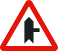
P-1a. Intersection with priority on road to the right
Danger due to the closeness of an intersection with a road on the right, whose users must give way.

P-1b. Intersection with priority on road to the left
Danger due to the closeness of an intersection with a road on the left, whose users must give way.
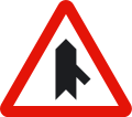
P-1c. Intersection with priority over approach from the right
Danger due to the closeness of an approach on the right of a road, whose users must give way.

P-1d. Intersection with priority over approach from the left
Danger due to the closeness of an approach on the left of a road, whose users must give way.

P-2. Intersection is governed by the general rule of priority
Danger due to the closeness of an intersection in which the general rule of priority of way applies. That means you need to give way to the vehicles on your right.
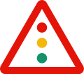
P-3. Traffic lights
Danger due to the proximity of an isolated intersection or track section, with traffic regulated by traffic lights.

P-4. Roundabout intersection
Danger due to the closeness of an intersection where traffic is carried out rotating in the direction of the arrows.
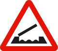
P-5. Mobile bridge
Danger due to the closeness of a bridge that can be raised or turned, thus temporarily interrupting circulation.
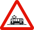
P-6. Tram Crossing
Danger due to the closeness of a crossing or intersection with a tram line, which has right-of-way.
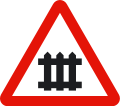
P-7. Railroad crossing with barriers (guarded)
Danger due to the closeness of a railroad crossing at the same level with barriers or semi-barriers.
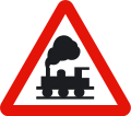
P-8. Railroad crossing with no barriers (unguarded)
Danger due to the closeness of a railroad crossing at the same level not provided with barriers or semi-barriers.

P-9a. Approach to a railroad crossing, mobile bridge or dock (right side)
Indicates, on the right side, the closeness of a railroad crossing or mobile bridge.

P-9b. Approach to a railroad crossing, mobile bridge or dock (right side)
Indicates, on the right side, the closeness of a railroad crossing, dock or mobile bridge, which is two thirds of the distance between it and the corresponding danger warning sign.

P-9c. Approach to a railroad crossing, mobile bridge or dock (right side)
Indicates, on the right side, the closeness of a railroad crossing, dock or mobile bridge, which is a third of the distance between it and the corresponding danger warning sign.

P-10a. Approach to a railroad crossing, mobile bridge or dock (left side)
Indicates, on the left side, the closeness of a railroad crossing or mobile bridge.

P-10b. Approach to a railroad crossing, mobile bridge or dock (left side)
Indicates, on the left side, the closeness of a railroad crossing, dock or mobile bridge, which is two thirds of the distance between it and the corresponding danger warning sign.

P-10c. Approach to a railroad crossing, mobile bridge or dock (left side)
Indicates, on the left side, the closeness of a railroad crossing, dock or mobile bridge, which is a third of the distance between it and the corresponding danger warning sign.

P-11. Location of a railroad crossing with no barriers
Danger due to the immediate presence of railroad crossing without barriers.

P-11a. Location of a railroad crossing without barriers and with more than one railway line
Danger due to the immediate presence of railroad crossing without barriers with more than one railway line.
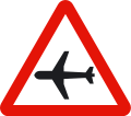
P-12. Airport
Danger due to the closeness of a place where airplanes frequently fly low over the road.
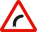
P-13a. Dangerous curve to the right
Danger due to the closeness of a dangerous curve to the right.
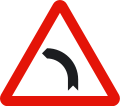
P-13b. Dangerous curve to the left
Danger due to the closeness of a dangerous curve to the left.
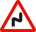
P-14a. Dangerous curves to the right
Danger due to the closeness of a succession of curves close to each other; the first of them, to the right.
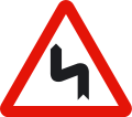
P-14b. Dangerous curves to the left
Danger due to the closeness of a succession of curves close to each other; the first of them, to the left.
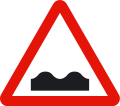
P-15. Uneven road
Danger due to the closeness of a hump or speed bump on the road or pavement in poor condition.

P-15a. Hump (Speed breaker)
Danger due to the closeness of a hump, also known as speed breaker, on the road.

P-15b. Dip in the road
Danger due the closeness of a dip on the road.
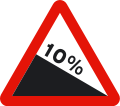
P-16a. Dangerous descent
Danger due to the existence of a track section with a steep downward slope. The figure indicates the slope in percentage.
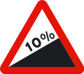
P-16b. Steep climb (Dangerous ascent)
Danger due to the existence of a track section with a strong upward slope. The figure indicates the slope in percentage.
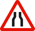
P-17. Road narrowing
Danger due to the closeness to an area where the road narrows.
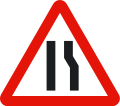
P-17a. Road narrowing on the right
Danger due to the closeness of an area of the road where the road narrows on the right side.
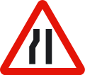
P-17b. Road narrowing on the left
Danger due to the closeness of an area of the road where the road narrows on the left side.
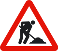
P-18. Roadworks
Danger due to the closeness of a track section with roadworks or under construction.
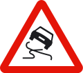
P-19. Slippery Pavement
Danger due to the closeness of an area of the road whose pavement can be very slippery.
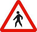
P-20. Pedestrians
Danger due to the proximity of a place frequented by pedestrians.
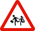
P-21. Children
Danger due to the closeness of an area frequented by children, such as schools, playground, etc.
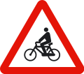
P-22. Cyclist
Danger due to the closeness of a cyclist crossing or a place where cyclists frequently appear on or cross the road.
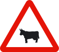
P-23. Passage of domestic animals
Danger due to the closeness of a place where the road can frequently be crossed by domestic animals.

P-24. Passage of animals moving freely
Danger due to the closeness of a place where the road can often be crossed by wild animals.

P-25. Driving in both directions
Danger due to the closeness of an area of the road where traffic is temporarily or permanently carried out in both directions.
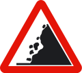
P-26. Detachment
Danger due to proximity to an area with frequent landslides and the consequent possible presence of obstacles on the road.
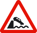
P-27. Dock
Danger due to the road leading to a pier, dock or a stream of water.
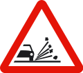
P-28. Stone chipping
Danger due to the closeness of a track section where there is a risk of gravel being projected when passing vehicles.
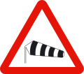
P-29. Cross Wind
Danger due to the closeness of an area where strong winds frequently blow in the cross direction.
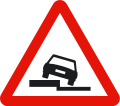
P-30. Side Slope
Danger due to the existence of a slope along the road on the side indicated by the symbol.
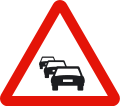
P-31. Road Congestion
Danger due to the closeness of a section where traffic is stopped or hampered by road congestion.
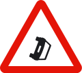
P-32. Road obstruction
Danger due to the closeness of a track section where vehicles are blocking the road due to breakdown, accident or other causes.
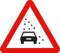
P-33. Reduced Visibility
Danger due to the closeness of a track section where traffic is hampered by a significant loss of visibility due to fog, rain, snow, smoke, etc.
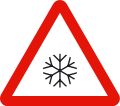
P-34. Sliding pavement due to ice or snow
Danger due to the closeness of an area of the road whose pavement can be particularly slippery due to ice or snow.

P-50. Other Hazards
Indicates the closeness of a hazard other than those warned by other signs.
2. Regulatory Signs
Regulatory Signs in Spain indicate priority, prohibition, obligation and restriction on the road.
They are frequently characterised by their circular shape, except the priority ones, which have special shapes given their importance over the rest of the signals.
2.1 Priority Signs

R-1. Give way / Yield sign
Obligation for all drivers to give way at the next intersection to vehicles traveling on the road they are approaching or the lane they intend to join.

R-2. Stop
Obligation for all drivers to stop their vehicles before the next stop line or, if it does not exist, immediately before the intersection, and yield there to the vehicles that circulate on the road to which he approaches. If, due to exceptional circumstances, there is insufficient visibility from the place where the stop was made, the driver must stop again at the place from where he / she has visibility, without endangering any road user.

R-3. Priority Road
Indicates to drivers of vehicles traveling on one road their priority at intersections over vehicles traveling on another road.

R-4. End of priority
Indicates the closeness of the place where the road on which you are driving loses its priority over another road.

R-5. Priority in reverse
Denied entry into a narrow passage as long as it is not possible to cross it without forcing vehicles traveling in the opposite direction to stop.
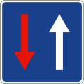
R-6. Priority over the opposite direction
Indicates to drivers that, at the next narrow passage, they have priority over vehicles driving in the opposite direction.
2.2 Denied Entry Signs
Prohibition of access signs are those that restrict access to an specific road. These signs are circular with white background and red border.

R-100. Prohibited driving
Prohibited driving to all kinds of vehicles in both directions.

R-101. Denied entry
Prohibition of access to all kinds of vehicles.
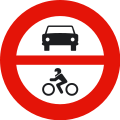
R-102. Denied entry to motor vehicles
Denied access to all kinds of motor vehicles.
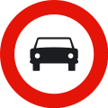
R-103. Denied entry to motor vehicles, except two-wheeled motorcycles without sidecar
Denied to all kinds of motor vehicles. It does not prohibit the access to two-wheeled motorcycles.
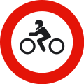
R-104. Denied entry to motorcycles
Denied access to motorcycles in general.
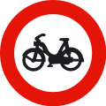
R-105. Denied entry to Mopeds
Denied access to two and three-wheel mopeds and light quadricycles. It also prohibits the entry of vehicles for people with reduced mobility.
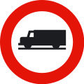
R-106. Denied access to all vehicles used for the carriage of goods
Denies access to all vehicles used for the transport of goods, understood as trucks and vans regardless of their mass.
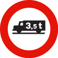
R-107. Denied entry to vehicles intended for the transport of goods with a higher authorized weight than indicated on the sign
Denied entry to all kinds of vehicles transporting goods if their maximum authorized weight is higher than the one indicated on the sign. Prohibits the access even if they drive empty.

R-108. Denied entry to vehicles carrying dangerous goods
Denied entry to all kinds of vehicles transporting dangerous goods. Also they must drive in accordance with their special regulations.
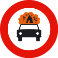
R-109. Denied entry to vehicles carrying explosive or flammable goods
Denied entry to all kinds of vehicles transporting explosive or easily flammable goods.

R-110. Denied entry to vehicles transporting water polluting products
Denied entry to all kinds of vehicles transporting more than a thousand liters of products capable of polluting water.
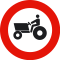
R-111. Denied entry to Agricultural motorised vehicles
Denied entry to tractors and other self-propelled agricultural machines.
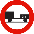
R-112. Denied entry to motor vehicles towing a trailer, other than a semitrailer or a single axle trailer
The inscription of a tonnage figure, either on the silhouette of the trailer or on an additional plate, means that the prohibition of entry only applies when the maximum authorized weight of the trailer exceeds this figure.
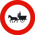
R-113. Denied entry to animal-drawn vehicles
Forbidden access to animal-drawn vehicles.
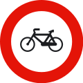
R-114. Denied entry to cycles
Forbidden access to cycles.
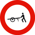
R-115. Denied entry to dragged carts
Forbidden access to dragged carts.
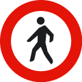
R-116. Denied entry to pedestrians
Forbidden access to all pedestrians.
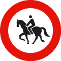
R-117. Denied entry to saddle animals
Forbidden access to saddle animals.
2.3 Traffic Restriction Signs
Traffic restriction signs prohibit or limit the access of vehicles that are facing them in the traffic direction and from the place where they are located.

R-200. Prohibition of passing without stopping
Indicates the place where detention is mandatory due to the proximity, according to the inscription it contains, of a customs office, police station, toll or others, and that, behind them, mechanical means of detention may be installed.
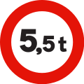
R-201. Weight limitation
Forbidden to pass to all the vehicles whose loaded weight, or total weight, exceeds that indicated in the sign in tons.
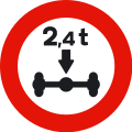
R-202. Axle weight limitation
Forbidden to pass to all the vehicles whose total weight on any of their axles exceeds the one indicated in the sign in tons.
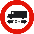
R-203. Length limitation
Forbidden to pass to all the vehicles whose maximum length, including the load, exceeds the one indicated in the sign.
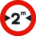
R-204. Width limitation
Forbidden to pass to all the vehicles whose maximum width, including the load, exceeds the one indicated in the sign.
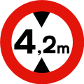
R-205. Height Limitation
Forbidden to pass to all the vehicles whose maximum height, including the load, exceeds the one indicated in the sign.
2.4 Other Prohibition or Driving Restriction Signs
They prohibit or restrict all drivers who encounter these signs head-on, from where they are located and in their traffic direction.
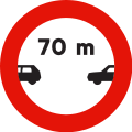
R-300. Minimum Separation
Prohibition of driving without maintaining a separation equal to or greater than that indicated on the sign with the preceding vehicle, except to overtake.
If it appears without the indication of meters, it is a generic reminder recalling the regulatory safety distance between vehicles must be observed.
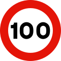
R-301. Maximum Speed
Prohibition of driving at a higher speed, in kilometers per hour, than the one indicated on the sign. It is mandatory from where the sign is located until the next "end of speed limitation", "end of prohibitions" or other "maximum speed" sign, unless it is placed on the same post as a danger warning sign or in the same panel as this one, in which case the prohibition ends when the indicated danger also ends. Located on a non-priority road, it ceases to be valid when leaving an intersection with a priority road. If the limit indicated by the sign coincides with the maximum speed allowed for this type of road, it is a generic reminder of the prohibition to exceed it.

R-302. Right turn prohibited
Prohibition to turn right for all types of vehicles.

R-303. Left turn prohibited
Prohibition to turn left. It also includes the prohibition of changing the direction of traffic.

R-304. U-turn Prohibited
Prohibition of changing the direction of the traffic.
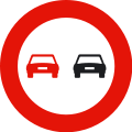
R-305. Ban on overtaking
In addition to the general overtaking principles, this sign indicates the prohibition of all vehicles from overtaking motor vehicles driving on the road, unless these are two-wheeled motorcycles and provided that the area reserved for the opposite direction is not invaded, from the place where the sign is located and until the next "End of overtaking prohibition" or "End of prohibitions" sign.
Placed in those sites where overtaking is prohibited by law, it generically recalls the prohibition to carry out this maneuver.
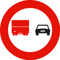
R-306. Overtaking prohibited for trucks
Indicates the prohibition of trucks whose maximum authorized mass exceeds 3,500 kg, to overtake motor vehicles driving on this road, unless these are two-wheeled motorcycles and provided that the area reserved to the opposite direction is not invaded, from the place where this sign is located and until the next "End of prohibition of overtaking for trucks" or "End of prohibitions" sign.

R-307. Stop and parking prohibited
Prohibition of stopping and parking on the side of the road where the sign is located. Unless otherwise indicated, the prohibition begins at the vertical of the sign and ends at the nearest intersection.

R-308. Parking prohibited
Prohibition of parking on the side of the road where the sign is located. Unless otherwise indicated, the prohibition begins at the vertical of the sign and ends at the nearest intersection. It does not ban stopping.
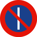
R-308a. Parking prohibited on odd days
Prohibition of parking on the side of the road where the sign is located, on odd days. Unless otherwise indicated, the prohibition begins at the vertical of the sign and ends at the nearest intersection. It does not prohibit stopping.

R-308b. Parking prohibited on even days
Prohibition of parking on the side of the road where the sign is located, on even days. Unless otherwise indicated, the prohibition begins at the vertical of the sign and ends at the nearest intersection. It does not prohibit stopping.
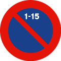
R-308c. No parking in the first half of the month
Parking is prohibited on the side of the road where the sign is located, from 9 a.m. on the 1st to 9 a.m. on the 16th of each month.
Unless otherwise indicated, the prohibition begins at the vertical of the sign and ends at the nearest intersection. It does not prohibit stopping.
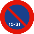
R-308d. No parking in the second half of the month
Parking is prohibited on the side of the road where the sign is located, from 9 a.m. on the 16th to 9 a.m. on the 1st of each month. Unless otherwise indicated, the prohibition begins at the vertical of the sign and ends at the nearest intersection. It does not prohibit stopping.

R-308e. No parking in front of an entrance
Parking is prohibited in front of a marked entrance.

R-309. Limited Parking Area
Parking area with limited duration where all drivers have the obligation to indicate, in a regulatory way, the time when the parking time starts.

R-310. Acoustic warnings banned
Remember the general prohibition of using acoustic warnings, except to avoid an accident.
2.5 Mandatory Signs
They are those that indicate a mandatory traffic rule.





R-400. Mandatory Direction
The arrow indicates the direction that all vehicles have the obligation to follow.



R-401. Mandatory Pass
The arrow points to the side of the shelter, traffic island or obstacle that vehicles must pass through.

R-402. Rotary-mandatory intersection (roundabout)
The arrows indicate the direction and the turning movement that all vehicles must follow.



R-403. Only allowed directions
The arrows indicate the only directions that all vehicles driving on that road can take.

R-404. Roadway for automobiles, except two-wheeled motorcycles without sidecar
Obligation for drivers of automobiles, except two-wheeled motorcycles without sidecar, to drive on the road at whose entrance this sign is located.

R-405. Roadway for two-wheeled motorcycles without sidecar
Obligation for drivers of two-wheeled motorcycles without sidecar to drive on the road at whose entrance this sign is located.

R-406. Roadway for Trucks
Obligation for drivers of all kinds of trucks, regardless of their weight, to drive on the road to whose entrance this sign is located. The inscription of a tonnage figure, either on the silhouette of the vehicle, or on another supplementary plate, means that the obligation only applies when the maximum authorized weight of the vehicle or of the group of vehicles exceeds that weight.

R-407a. Road reserved for cycles or cycle path
Obligation for cycle drivers to drive on the road to whose entrance this sign located and prohibition of other road users from using it.

R-407b. Road reserved for mopeds (moped sign)
Obligation for moped drivers to drive on the road to whose entrance this sign is located and prohibition of other road users from using it.

R-408. Path for vehicles pulled by animal force
Obligation for drivers of vehicles pulled by animal force to use the path to whose entrance it is located.

R-409. Path reserved for saddle animals
Obligation for horse riders with their saddle animals to use the path in the entrance of which this sign is located and prohibition of other road users from using it.
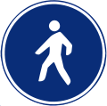
R-410. Pedestrian reserved path
Obligation for pedestrians to travel on the road to whose entrance this sign is located and prohibition of other road users from using it.

R-411. Minimum SpeedObligation for vehicles to drive, at least, at the speed indicated by the figure, in kilometers per hour, that appears on the sign, from the place where it is located to another with a different 'minimum speed', or an 'end of minimum speed' or 'maximum speed' sign of equal or lower value.

R-412. Snow chains
Obligation not to continue driving without snow chains or other authorized devices, which act on at least one wheel on each side of the same motor shaft.

R-413. Low-Beam Headlights (Luz de Corto alcance or Cruce in Spanish)
Obligation to drive with low-beam headlights at least, regardless of the visibility or lighting conditions of the road, from the place where the sign is located to the place where we find another sign ending the obligation.

R-414. Roadway for vehicles transporting dangerous goods
Obligation for drivers of all types of vehicles transporting dangerous goods to drive on the road to whose entrance this sign is located.

R-415. Roadway for vehicles transporting water pollutants
Obligation for drivers of all types of vehicles transporting more than 1,000 liters of products capable of contaminating the water, to drive on the road at whose entrance this sign is located.

R-416. Roadway for vehicles transporting explosive or flammable materials
Obligation for drivers of all types of vehicles transporting explosive or flammable goods, to drive on the road to whose entrance this sign is located.

R-418. Exclusive roadway for vehicles equipped with operational electronic toll equipment
Mandatory electronic toll. Obligation to pay the toll through the dynamic or electronic toll system; The vehicle traveling on the lane or lanes thus marked must have the technical means that enables its use in operational conditions in accordance with the legal road regulations.
2.6 End of prohibition or restriction signs

R-500. End of prohibitions
Indicates the place from where all local prohibitions, indicated by previous prohibition signs for moving vehicles, cease to apply.

R-501. End of speed restriction
Indicates the place from where a previous "maximum speed" sign is no longer applicable.
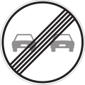
R-502. End of overtaking ban
Indicates the place from where a previous "overtaking ban" sign is no longer applicable.
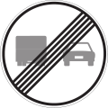
R-503. End of overtaking ban for trucks
Indicates the place from where a previous "no overtaking for trucks" sign is no longer applicable.

R-504. End of limited parking area
Indicates the place from where a previous "limited parking area" sign is no longer applicable.
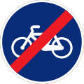
R-505. End of cycle reserved track
Indicates the place from where a previous End of cycle reserved track is no longer applicable.
3. Indication Signs
Indication Traffic Signs are those that inform the driver about something of interest.
These are square or rectangular blue signs with white elements and borders.

S-1. Highway
Indicates the beginning of a highway/motorway and, therefore, the place from which the special traffic rules apply on this type of road. The symbol of this sign can announce the proximity of a highway or indicate the branch of an intersection that leads to a highway.

S-1a. Dual Carriageway
Indicates the beginning of a dual carriageway and, therefore, the place from which the special traffic rules apply on this type of road. The symbol of this sign can announce the proximity of a dual carriageway or indicate the branch of an intersection that leads to a dual carriageway.

S-2. End of highway
Indicates the end of a Highway.

S-2a. End of Dual Carriageway
Indicates the end of a Dual Carriageway.

S-3. Track reserved for cars
Indicates the beginning of a track reserved for cars.

S-4. End of track reserved for cars
Indicates the end of a track reserved for cars.

S-5. Tunnel
Indicates the beginning and sometimes the name of a tunnel, an underpass or a track section equivalent to a tunnel. It may bear the indication of the length of the tunnel in meters at the bottom.

S-6. End of Tunnel
Indicates the end of a tunnel, an underpass or a track section equivalent to a tunnel.
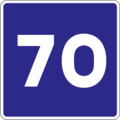
S-7. Recommended maximum speed
This sign recommends an approximate driving speed, in kilometers per hour, which it is advisable not to exceed, even if the weather and environmental conditions of the road are favorable. When placed under a hazard warning sign, the recommendation refers to the track section where the hazard persists.
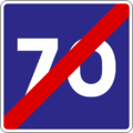
S-8. End of recommended maximum speed
Indicates the end of a track section in which it is recommended to drive at the speed in kilometers per hour indicated on the sign.

S-9. Recommended Speed Interval
It is recommended to keep the speed between the indicated values, but only if the meteorological and environmental conditions of the road are favorable. When placed under a hazard warning sign, the recommendation refers to the track section where the hazard persists.

S-10. End of recommended speed interval
Indicates the place from where a previous "recommended speed interval" sign is no longer applicable.

S-11. One-way roadway (one lane)
Indicates that, on the road extended in the direction of the arrows (two lanes in this one), vehicles must circulate in the direction indicated by them, being forbidden the movement in the opposite direction.

S-11a. One-way roadway (two lanes)
Indicates that, on the road extended in the direction of the arrows (two lanes in this one), vehicles must circulate in the direction indicated by them, being forbidden the movement in the opposite direction.

S-11b. One-way roadway (three lanes)
Indicates that, on the road extended in the direction of the arrows (three lanes in this one), vehicles must drive in the direction indicated by these, and driving in the opposite direction remains prohibited.

S-12. One-way track section
Indicates that, on the track section where the direction of the arrow is extended, vehicles must drive in the direction indicated by the arrow, and driving in the opposite direction remains prohibited.
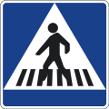
S-13. Location of a Pedestrian Crossing
Indicates the location of a Pedestrian Crossing.

S-14a. Pedestrian Overpass
Indicates the location of a Pedestrian Overpass.

S-14b. Pedestrian Underpass
Indicates the location of a Pedestrian Underpass.



S-15. Pre-signaling of a Dead-end roadway
Indicates that, from the roadway that appears in the sign with a red box, vehicles can only exit through the entry point.

S-16. Emergency braking zone
Indicates the location of an escape zone on the road, prepared so that a vehicle can be stopped in case of failure of its braking system.

S-17b. Parking
Indicates a location where vehicle parking is authorized. An inscription or symbol, representing certain types of vehicles, indicates that parking is just reserved for these vehicles. An inscription with time indications restricts the duration of the designated parking.

S-18. Place reserved for taxis
Indicates the place where free and in service taxis can stop or park. The inscription of a figure indicates the total number of spaces set aside for this purpose.

S-19. Bus stop
Indicates the place reserved for a bus stop.

S-20. Tram Stop
Indicates the place reserved for a tram stop.
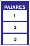
S-21. Mountain Pass
Indicates the passability of the mountain pass or track section defined in the upper part of the sign. Panel 1 of the S-21 sign willl bear one of these two indications: "open" (1.a), "closed" (1.b). Panel 2 of the S-21 sign may be blank, in which case it does not indicate any prescription; or indicate that the use of snow chains is mandatory or recommended. When panel 1 of the S-21 sign indicates “closed”, panel 3 may bear the indication of which part of the road is passable, under the conditions indicated in panel 2.
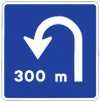
S-22. U-turn at the same level
Indicates the proximity of an exit through which a change of direction or u-turn can be made at the same level.
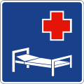
S-23. Hospital
Indicates to all vehicle drivers the convenience of taking the required precautions because of the closeness of medical establishments, especially to avoid making noise.

S-24. End of Low-beams headlights obligation
Indicates the end of a track section in which the use of low-beam headlights is mandatory and reminds you of the possibility of dispensing with it, as long as the use it is not imposed by circumstances of visibility, schedule or road lighting.
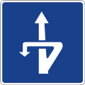
S-25. Change of direction at different level
Indicates the proximity of an exit through which a change of direction can be made at a different level.


S-26. Exit approach panel
Indicates on a motorway, dual carriageway or car track that the next exit is located approximately 300, 200 and 100 meters away respectively.
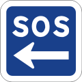
S-27. Road assistance
Indicates the location of the nearest help point or aid station where help can be requested in the event of an accident or breakdown. The sign can indicate the distance to the aid station.

S-28. Residential Area
Indicates specially conditioned traffic areas that are primarily intended for pedestrians and where the following special traffic regulations apply: the maximum speed of vehicles is set at 20 kilometers per hour and drivers must give priority to pedestrians. Vehicles must not park other than in the places designated by signs or marks.
Pedestrians can use the entire driving area. Games and sports are authorized in it. Pedestrians must not unnecessarily interfere with vehicle drivers.

S-29. End of residential area
Indicates that the general traffic regulations apply again.

S-30. Zone 30 km/h
Indicates that we enter in an area specially adapted for a preferential pedestrian use. The maximum allowed speed for vehicles is fixed at 30 kilometers per hour. Pedestrians have priority.

S-31. End of zone 30 km/h
Indicates that the general traffic regulations apply again.

S-32. Electronic Toll
Indicates that the vehicle driving on the lane or lanes thus marked can make the payment of the toll with dynamic toll system or electronic toll means, only if it has the necessary technical means that enables its use.

S-33. Cycle path
Indicates the existence of a path for pedestrians and cycles, segregated from motorized traffic, and that runs through open spaces, parks, gardens or forests.
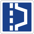
S-34. Siding in tunnels
Indicates the location of a place where the vehicle can be set aside in a tunnel, in order to clear the way.

S-34a. Emergency Siding in tunnels
Indicates the location of a place where the vehicle can be set aside in a tunnel in order to clear the way, and where you can find out an emergency telephone.
3.1 Traffic Lane Signs
These signs indicate the purpose of the traffic lanes or turn from one to several, etc.


S-50. Traffic Lanes, mandatory for slow traffic and reserved for fast traffic
Indicates that the traffic lane on which the minimum speed sign is located can only be used by vehicles traveling at a speed equal to or greater than the one indicated, although if circumstances permit they must travel in the right lane.

S-51. Traffic lane reserved for buses
Indicates the prohibition for drivers of vehicles other than collective transport to driving in the indicated lane. The word 'taxi' on it also authorizes taxis to use this lane.
In the track sections in which the longitudinal white mark is constituted, on the outer side of this lane, by a broken line, its general use is allowed exclusively to carry out some maneuver, other than stopping, parking, changing the direction of travel or overtake, always giving way to buses and, where appropriate, taxis.


S-52. End of a traffic lane
Pre-signals the traffic lane that will cease to be usable, indicating the precise lane change.

S-53. Turn from one to two traffic lanes
Indicates in a track section with a single lane in one direction of traffic, that in the next section there will be two lanes in the same direction of traffic.

S-53b. Turn from two to three traffic lanes
Indicates, in a track section with two traffic lanes in one direction of traffic, that in the next section there will be three lanes in the same direction of traffic.

S-60a. Fork to the left on a two-lane road
Indicates, on a road with two lanes in the same direction, that in the next track section the lane on the left will fork towards this same side.

S-60b. Fork to the right on a two-lane road
Indicates, on a road with two lanes in the same direction, that in the next track section the lane on the right will fork towards this same side.

S-61a. Fork to the left on a three-lane road
Indicates, on a road with three lanes in the same direction, that in the next track section the lane on the left will fork towards this same side.

S-61b. Fork to the right on a three-lane road
Indicates, on a road with three lanes in the same direction, that in the next track section the lane on the right will fork towards that same side.
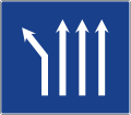
S-62a. Fork to the left on a four-lane road
Indicates, on a road with four lanes in the same direction, that in the next track section the lane on the left will fork to that same side.
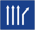
S-62b. Fork to the right on a four-lane road
Indicates, on a road with four lanes in the same direction, that in the next track section the lane on the right will fork towards that same side.

S-63. Fork in four-lane road
Indicates, on a road with four lanes in the same direction, that in the next track section the two lanes on the left will fork to the left and the two on the right will fork to the right.


S-64. Bike path or cycle path attached to the road
Indicates that the lane where the cycle lane sign is located can only be used by cycles. The arrows will indicate the number of lanes on the roadway, as well as their direction of traffic.
3.2 Service Signs
The following signs indicate the location of a road service.

S-100. Aid Station
Indicates the location of an officially recognized center where an emergency treatment can be performed.

S-101. Ambulance services
Indicates the location of an ambulance in permanent service to cure and transfer injured people in car accidents.

S-102. Technical inspection of vehicles Service
Indicates the location of a Technical inspection of vehicles station (ITV).

S-103. Repair shop
Indicates the location of a car repair shop.

S-104. Emergency Phone
Indicates the situation of a permanently used telephone to warn the authorities of the existence of an accident or emergency on the road.

S-105. Fuel Station
Indicates the location of a fuel dispenser or service station.

S-106. Repair shop and fuel pump
Indicates the location of car facilities with repair shop and fuel pump.

S-107. Camp Area
Indicates the location of a place where you can camp.

S-108. Water
Indicates the situation of a water fountain.

S-109. Picturesque place
Indicates the location of a picturesque place or the place from which it is seen.

S-110. Hotel or motel
Indicates the location of a hotel or motel.

S-111. Catering
Indicates the location of a restaurant.

S-112. Coffee Shop
Indicates the location of a bar or coffee shop.

S-113. Field for mobile homes
Indicates the situation of a terrain where you can camp with a mobile home (caravan).

S-114. Picnic Area
Indicates the place that can be used for the consumption of food or drink.

S-115. Starting point for walking tours
Indicates an appropriate place to start walking tours.

S-116. Camping and mobile home ground
Indicates the location of a place where you can camp with a tent or with a mobile home.

S-117. Youth Hostel
Indicates the situation of a hostel whose use is reserved for youth organizations.

S-118. Tourist information
Indicates the location of a tourist information office.

S-119. Fishing preserve
Indicates a section of the river or lake where fishing is subject to special authorization.

S-120. National Park
Indicates the location of a national park whose name is not written.

S-121. Monument
Indicates the location of a historical or artistic work declared a monument.

S-122. Other services
Generic signal for any other service, which will be written in the white box.

S-123. Rest Area
Indicates the location of a rest area.

S-124. Railway users parking
Indicates the location of a parking area connected to a railway station and intended mainly to park the vehicles of users who make part of their trip in their own private vehicle and the other by rail.

S-125. Parking for users of the underground railway
Indicates the location of a parking area connected to an underground railway station and intended mainly to park the vehicles of users who make part of their journey in their own private vehicle and the other by underground railway.

S-126. Parking for bus users
Indicates the location of a parking area arranged with a station or a bus terminal and intended mainly to park the private vehicles of users who make part of their trip in their own private vehicle and the other by bus.

S-127. Service Area
Indicates the location of a service area on a highway or dual carriageway.
3.3 Orientation Signs
Within the orientation signs we find different types of them: Pre-signposting, direction, road identification, location, confirmation and specific use in town signs.
3.3.1 Pre-signaling signs

S-200. Roundabout pre-signaling
Indicates the directions of the different exits of the next roundabout. If any inscription appears on a green or blue background indicates that the exit leads towards a fast lane or towards a motorway or dual carriageway.

S-220. Pre-signaling of directions towards a conventional road
Indicates, on a conventional road, the directions of the different branches of the next intersection when one of them leads to a conventional road.

S-222. Pre-signaling of directions towards a motorway or dual carriageway
Indicates, on a conventional road, the directions of the different branches of the next intersection when one of them leads to a highway or a dual carriageway.
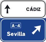
S-222a. Pre-signaling of directions towards a motorway or dual carriageway with their own direction
Indicates, on a conventional road, the directions of the different branches of the next intersection when one of them leads to a highway or a dual carriageway. It also indicates the direction of the conventional road.

S-225. Pre-signaling of directions on a motorway or dual carriageway to any road
Indicate the directions of the different branches at the next intersection on a highway or dual carriageway. It also indicates the distance, the number and, where appropriate, the letter of the interchange and branch.

S-230. Pre-signaling with signs on the roadway on a conventional road towards a conventional road
Indicates the directions of the branch of the next exit and the distance to it.

S-230a. Pre-signaling with signs on the roadway on a conventional road towards another conventional road with his own direction
Indicates the directions of the branch of the next exit and the distance to it. It also indicates the proper direction of the conventional road.

S-232. Pre-signaling with signs on the roadway on a conventional road towards a motorway or dual carriageway
Indicates the directions of the branch of the next exit and the distance to it.

S-232a. Pre-signaling with signs on the roadway on a conventional road towards a motorway or dual carriageway with their own direction
Indicates the directions of the branch of the next exit and the distance to it. It also indicates the proper direction of the conventional road.

S-235. Pre-signaling with signs on the road on a motorway or dual carriageway to any road
Indicates the directions of the branch of the next exit, the distance at which it is located and the interchange number.

S-235a. Pre-signaling with signs on the road on a motorway or dual carriageway towards any road and with their own direction.
Indicates the directions of the branch of the next exit, the distance at which it is located and the interchange number. It also indicates the proper direction of the highway or dual carriageway.

S-242. Pre-signaling on a motorway or dual carriageway of two close exits towards any road
Indicates the directions of the branches of two consecutive exits of a highway or dual carriageway, the distance, the number of the interchange and the letter of each exit.

S-242a. Pre-signaling on a motorway or dual carriageway of two close exits to any road and with their own direction
Indicates the directions of the branches of two consecutive exits of the highway or dual carriageway, the distance, the number of the interchange and the letter of each exit. It also indicates the proper direction of the highway or dual carriageway.

S-250. Itinerary pre-marking
Indicates the itinerary that must be followed to take the direction indicated by the arrow.

S-260. Lane pre-marking
Indicates the only allowed directions, at the next intersection, to users traveling in the designated lanes.
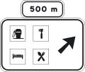
S-261. Pre-signaling on a conventional road for a service area
Indicates, on a conventional road, the proximity of an exit to a service area.

S-263. Pre-signaling on a motorway or dual carriageway of a service area with shared exit
Indicates, on a motorway or dual carriageway, the proximity of an exit to a service area, this being the same as an exit to one or more towns.
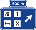
S-263a. Pre-signaling on a highway or dual carriageway of a service area with exclusive exit
Indicates, on a motorway or dual carriageway, the proximity of an exit to a service area.

S-264. Pre-signaling on a conventional road of a service road
Indicates, on a conventional road, the proximity of an exit to a service road from which the indicated services can be accessed.

S-266. Pre-signaling on a motorway or dual carriageway of a service road, with shared exit
Indicates on a motorway or highway, the proximity of an exit to a service road from which the indicated services can be accessed, this being the same as an exit to one or more towns.

S-266a. Pre-signaling on a motorway or dual carriageway of a service road, with exclusive exit
Indicates, on a motorway or dual carriageway, the proximity of an exit to a service road from which the indicated services can be accessed.
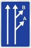
S-270. Pre-signaling of two close exits
It indicates the proximity of two consecutive exits between which, due to lack of sufficient distance between them, it is not possible to install other individualized orientation signs for each exit. The letters or, where appropriate, the numbers correspond to those of the immediately preceding pre-signaling signals.
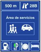
S-271. Pre-marking of a service area
Indicates, on a highway or dual carriageway, the exit to a service area.
3.3.2 Direction Signs

S-300. Towns of a conventional road itinerary
Indicates names of towns located on an itinerary made up for a conventional road and the direction by which they are reached. The box located inside the sign defines the category and number of the road. The figures written within the sign indicate the distance in kilometers.

S-301. Towns on a highway or dual carriageway itinerary
Indicates names of towns located on an itinerary made up for a motorway or dual carriageway and the direction by which they are reached. The box located inside the sign defines the category and number of the road. The figures written within the sign indicate the distance in kilometers.

S-310. Towns of different itineraries
Indicates roads and towns that are reached in the direction indicated by the arrow.

S-320. Places of interest on a conventional road
Indicates places of general interest that are not towns, located on an itinerary made up on a conventional road. The figures written within the sign indicate the distance in kilometers.

S-321. Places of interest on a motorway or dual carriageway
Indicates places of interest that are not towns located on an itinerary made up of a motorway or dual carriageway. The figures written within the sign indicate the distance in kilometers.

S-322. Destination sign towards a cycle lane or cycle path
Indicates the existence of a cycle path or cycle path in the direction pointed by the arrow. The figures written inside the sign indicate the distance in kilometers.

S-341. Immediate departure destination signs to conventional road
Indicates the place of departure from a highway or dual carriageway towards another highway or dual carriageway or from a highway to a conventional road. The figure indicates the interchange number.

S-342. Immediate exit destination signs to motorway or dual carriageway
Indicates the place of departure from a highway or dual carriageway to another highway or dual carriageway. The figure indicates the interchange number.

S-344. Immediate exit destination signs to a road service area
Indicates the exit point of any road to a road service area.

S-347. Immediate exit destination signs to a zone or a road service area, with a shared exit to a highway or dual carriageway
Indicates the place where any road exits to a zone or road service area, this being the same as an exit to a highway or dual carriageway.

S-348a. Destination on diversion Sign
It indicates that a certain destination is reached by the provisional diversion itinerary and in the direction indicated by the arrow.

S-348b. Variable destination sign
Indicates that in the direction pointed by the arrow you can reach the destination that appears on the sign.

S-350. Sign on the road, on a conventional road. Immediate exit to a conventional road
It indicates on a conventional road, the place where the exit branch begins, the directions reached by the immediate exit from a conventional road and, where appropriate, its number.
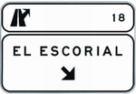
S-351. Sign on the road on a motorway or dual carriageway
It indicates on a motorway or dual carriageway, the place where the exit branch of any road begins, the directions that are reached by the immediate exit from a conventional road and, where appropriate, its number. It also indicates the number and, where appropriate, the letter of the link and branch.
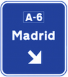
S-354. Sign on the road, on a conventional road. Immediate exit to motorway or dual carriageway
It indicates the place where the exit branch begins, the directions that are reached by the immediate exit from a motorway or a dual carriageway and, where appropriate, the number of these.
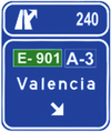
S-355. Sign on the road, on a motorway, dual carriageway or expressway. Immediate exit to motorway or dual carriageway
It indicates the place where the exit branch begins, the directions that are reached by the immediate exit from a motorway or a dual carriageway and, where appropriate, the number of these. It also indicates the number and, where appropriate, letter, of the link and branch.

S-360. Signs on the road on a conventional road. Immediate exit to a conventional road and his own direction
Indicates, on a conventional road, the directions reached by the immediate exit to another conventional road. It also indicates the proper direction of the conventional road and its number.

S-362. Signs on the road on conventional roads. Immediate exit to highway or dual carriageway and his own direction
Indicates, on a conventional road, the directions that are reached by the immediate exit to a highway or dual carriageway. It also indicates the proper direction of the conventional road.

S-366. Signs on the road on a highway or dual carriageway. Immediate exit to conventional road and his own direction
Indicates, on a highway or dual carriageway, the directions that are reached by the immediate exit to a conventional road, as well as the number of the interchange and, where appropriate, the letter of the branch. It also indicates the proper direction of the highway or dual carriageway.

S-368. Signs on the road on a highway or dual carriageway. Exit to a motorway or dual carriageway and his own direction
Indicates, on a highway or dual carriageway, the directions that are reached by the immediate exit to a highway or dual carriageway, as well as the interchange number and, where appropriate, the branch letter. It also indicates the proper direction of the highway or dual carriageway.

S-371. Signs on the road on a conventional road
Two immediate exits very close to a conventional road and his own direction.

S-373. Signs on the road on a highway or dual carriageway. Two immediate exits very close to a conventional road and his own direction.
It indicates the directions of the branches of the two consecutive exits of the highway or dual carriageway, the distance to the second one, the number of the interchange and the letter of each exit. It also indicates the proper direction of the highway or dual carriageway.

S-375. Signs on the road on a highway or dual carriageway. Two immediate exits very close to the motorway or dual carriageway and their own direction.
It indicates the directions of the branches of the two consecutive exits of the highway or dual carriageway, the distance to the second one, the number of the interchange and the letter of each exit. It also indicates the proper direction of the highway or dual carriageway.
3.3.3 Road Identification Signs

S-400. European Itinerary
Identifies an itinerary of the European Road Network.

S-410. Motorway (highway) or dual carriageway
Identifies a motorway or dual carriageway. When it is from an Autonomous Region, in addition to the letter A and after the corresponding number or above the sign with a complementary panel, the identification initials of the Autonomous Region may be included.
No road that does not have the characteristics of a motorway or dual carriageway may be identified with the letter A.
When the highway or dual carriageway is a beltway or bypass, the letter A may be replaced by the letters indicating the city, in accordance with the code established for this purpose by the Ministries of Development and Internal Affairs.

S-410a. Toll motorway
Identifies a Toll motorway.

S-420. Road part of the general State road network
Identify a road in the general state road network that is not a highway or highway.

S-430. First Level Regional Road
Identifies a first level Regional road, other than a motorway or dual carriageway, of the Autonomous Region network to which the identification initials correspond.

S-440. Second Level Regional Road
Identifies a second level Regional road, which is not a motorway or dual carriageway, of the Autonomous Regional network to which the identification acronyms correspond.

S-450. Third Level Regional Road
Identifies a third level Regional road, which is not a motorway or dual carriageway, of the Autonomous Regional network to which the identification acronyms correspond.
3.3.4 Location Signs

S-500. Entrance to the town
Indicates that you have entered a town and that from that point on, the town traffic rules apply.

S-510. Exit of the town
Indicates that you left a town and that from that point on, the traffic rules in town are no longer applied.

S-520. Location of characteristic point of the road
Indicates a place of general interest on the road.

S-540. Entrance to the Province
Indicates you’ve entered another province.

S-550. Entrance to the Autonomous Region
Indicates that you’re entering an Autonomous Region, showing only the name of the Autonomous Region.
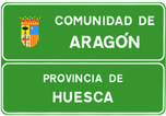
S-560. Entrance to the Autonomous Region
Indicates that you entered to another autonomous region, showing its name and province.
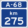
S-570. Kilometric milestone on a Motorway or Highway
Indicates the kilometric point of the Highway or Highway whose identification appears at the top.
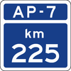
S-570a. Milestone on a Toll Highway
Indicates the kilometric point of the Toll Highway whose identification appears at the top.
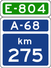
S-571. Kilometric milestone on a motorway or highway that is part of a European Itinerary
Indicates the kilometric point of a Motorway or Highway that is also part of a European Itinerary, whose identification appears at the top of the sign.
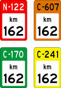
S-572. Kilometric Milestone on Conventional Road
Indicates the kilometric point of a Conventional Road whose identification appears in the upper part of the sign, over the background of the color that corresponds to the road network to which it belongs:
RED: Road part of the State Road Network (see sign S-420).
ORANGE: First level Regional Road (see sign S-430).
GREEN: Second level Regional Road (see sign S-440).
YELLOW: Third level Regional Road (see sign S-450).
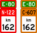
S-573.Kilometric Milestone on a European itinerary
Indicates the kilometric point of a Conventional Highway that is part of a European Itinerary, whose letters and numbers appear at the top of the sign.
RED: Road part of the State Road Network (see sign S-420).
ORANGE: 1st Level Regional Road (see sign S-430).


S-574. Myriametric milestone on Motorway, Highway or Conventional Road
Indicates the kilometer point when it is a multiple of 10.
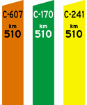
S-575. Myriametric milestone
Indicates the kilometric point of a road, which is not a motorway or highway, when it is a multiple of 10.
Its color will correspond to that of the network of which is part:
ORANGE: 1st level Regional Road (see sign S-430).
GREEN: 2nd level Regional Road (see sign S-440).
YELLOW: 3rd level Regional Road (see sign S-450).
3.3.5 Confirmation Signs
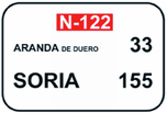
S-600. Confirmation of cities on a conventional road itinerary
Indicates, on conventional roads, the name and distance in kilometers to the expressed cities.

S-602. Confirmation of towns on a highway or motorway itinerary
Indicates, on a motorway or highway, the name and distance in kilometers to the expressed towns.
3.3.6 Specific Use in Town Signs

S-700. Places of the urban road network
Indicates the names of streets, avenues, squares, roundabouts or any other point on the road network.

S-710. Places of interest for travelers
Indicates places of interest for travelers, such as stations, airports, boarding areas of ports, hotels, campings, tourist offices and automobile clubs.

S-720. Places of sporting or recreational interest
Indicate places where sports or recreational interest predominate.

S-730. Lugares de carácter geográfico o ecológico
Indica los lugares de tipo geográfico o de interés ecológico.

S-740. Places of monumental or cultural interest
Indicates places of monumental, historical, artistic or, in general, cultural interest.

S-750. Industrial use areas
Indicates the areas of major attraction for trucks, and in general, heavy industrial traffic.

S-760. Motorways and highways
It indicates the motorways and highways and the places that can be accessed through them.

S-770. Other places and roads
It indicates the roads that are not motorways or highways, the towns that can be accessed through them, as well as other places of public interest not included in the signs S-700 to S-760.
3.4 Complementary Panels

S-800. Distance to the beginning of the hazard or prescription
It indicates the distance from the place where the signal is to the one where the danger begins or the prescription of that begins to govern. In the event that it is placed under the road narrowing hazard warning sign, it can indicate the free width of said narrowing.

S-810. Length of the dangerous stretch under prescription
Indicates the length to which the hazard exists or the prescription applies.

S-820, S-821. Extension of the ban, on one side
Placed under a prohibition sign, it indicates the distance in which this prohibition applies in the direction of the arrow.

S-830. Extension of the ban, on both sides
Placed under a prohibition sign, it indicates the distances in which this prohibition applies in each direction indicated by the arrows.

S-840. Mandatory detention pre-marking
Placed under the yield sign, it indicates the distance to the mandatory stop sign or to the next intersection stop.


S-850, S-851, S-852, S-853. Itinerary with priority
Additional panel of the R-3 sign, which indicates the itinerary with priority.

S-860. Generic
Panel for any other clarification or delimitation of the signal or traffic light under which it is placed.

S-870. Sign Application
It indicates, under the prohibition or prescription sign, that it refers exclusively to the exit branch whose direction coincides approximately with that of the arrow.
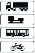
S-880. Application of signaling to certain vehicles
Indicates, under the corresponding vertical sign, that the sign refers exclusively to the vehicles listed on the panel, and that they can be trucks, vehicles with trailers, buses or cycles.
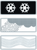
S-890. Complementary panel of a vertical sign
It indicates, under another vertical signal, that it refers to the circumstances indicated on the panel such as snow, rain or fog.
3.5 Other signs
Other indication signs are the following:
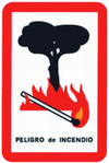
S-900. Fire Danger
It warns of the danger of lighting a fire.

S-910. Fire Extinguisher
Indicates the location of a fire extinguisher.

S-920. Entry to Spain
Indicates that you have entered to the Spanish territory on a road from another country.

S-930. Country confirmation
Indicates the name of the country to which the road is heading. The figure at the bottom indicates how far away the border is.
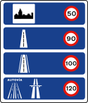
S-940. Speed limitations in Spain
Maximum speed information sign located in each type of road. This sign is placed at the entrance of the Spanish territory when coming from a road from another country or next to a customs office.
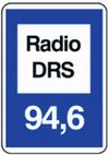
S-950. Radio frequency of specific stations for road information
Indicates the frequency to which the radio frequency receiver must be connected to receive road information.

S-960. Emergency Phone
Indicates the location of an Emergency Phone on the road.

S-970. Rest Stop
Indicates the location of a sidetrack with a fire extinguisher and an emergency telephone.

S-980. Emergency Exit
Indicates the location of an emergency exit.

S-990. Sign with arrow indicating emergency signal in tunnels
Indicates the direction and distance to an emergency exit.


